
EL BROCAL: REDCO PERU COLLECTS GEOMECHANICAL DATA FOR MORE PRECISE DECISION-MAKING IN MINE DESIGN
The rock mass analysis at the El Brocal operation, located in Pasco, will make it possible to adjust extraction methods, size excavations and anticipate critical instability zones.
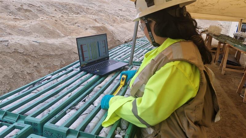
In order to strengthen mine planning and mine design processes, the Geomechanics team at REDCO Peru completed a critical data collection campaign at the El Brocal operation (Pasco region) and its Río Seco processing plant (Huaral). The work integrated field information and geotechnical analysis to model the behavior of the rock mass.
To address the geological and structural complexity inherent to deposits of this scale, the data collection required a rigorous level of detail. Miguel Cuadros, Senior Geomechanics Project Engineer at REDCO Peru and leader of the initiative, explained that the methodology applied makes it possible to map the variability of the ground accurately, regardless of the challenges the rock may present.
“Our approach allows us to assess how the different geomechanical variables of the rock mass interact. In this way, we give the operation the exact data it needs to define working domains under the highest safety and profitability standards”, the engineer explained.
To characterize the ground, the specialists applied advanced structural measurements, assessing rock quality designation (RQD) indices and the condition of the discontinuities. This made it possible to apply industry-standard classifications such as RMR and Q, which are essential for projecting the stability of future excavations.
Field mapping makes it possible to identify early on those sectors that, because of their fracture density or structure, could generate local instabilities. This is key to anticipating the technical challenges in ground support systems.
The data obtained will dictate the size of the excavations, the selection of extraction methods and the infrastructure reinforcements required. In practice, updating these models makes it possible to adjust the mining sequence, directly impacting efficiency, risk control and the safety of the Peruvian operation.
Cuadros stressed the strategic value of this type of study: “They significantly reduce the uncertainty associated with mine design by validating assumptions and improving the quality of geotechnical models. Integrating field data with standardized criteria ensures consistency in the information, yielding far more representative results for decision-making than studies based solely on indirect information”.